14th Nov, 2025 • 07:14 PM
Explore the hidden Tsum Valley and the legendary Manaslu Circuit—an off-the-beaten-path trek combining raw Himalayan landscapes, Tibetan Buddhist culture, ancient monasteries, and the dramatic Larkya La Pass at 5,106 meters.
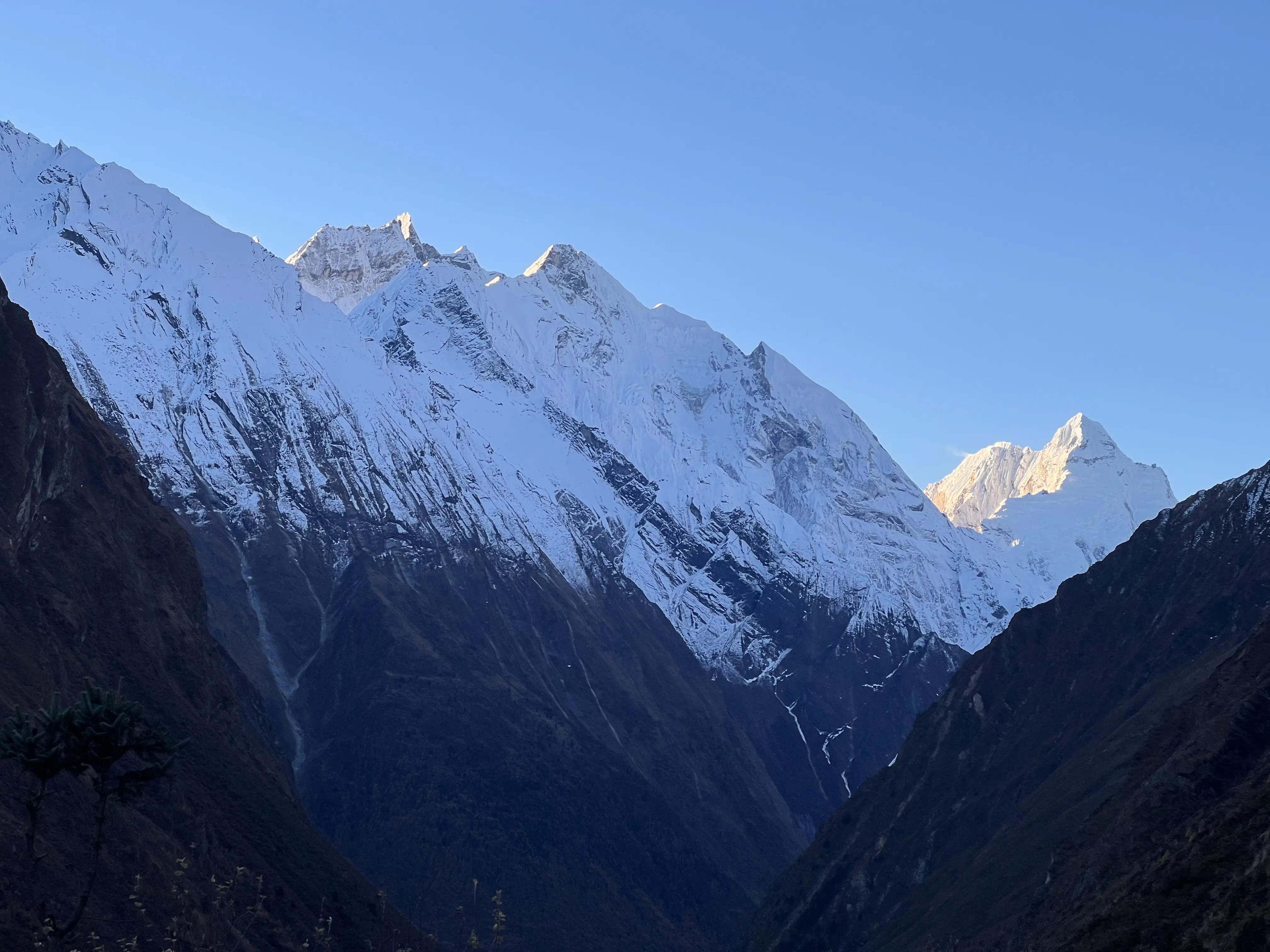
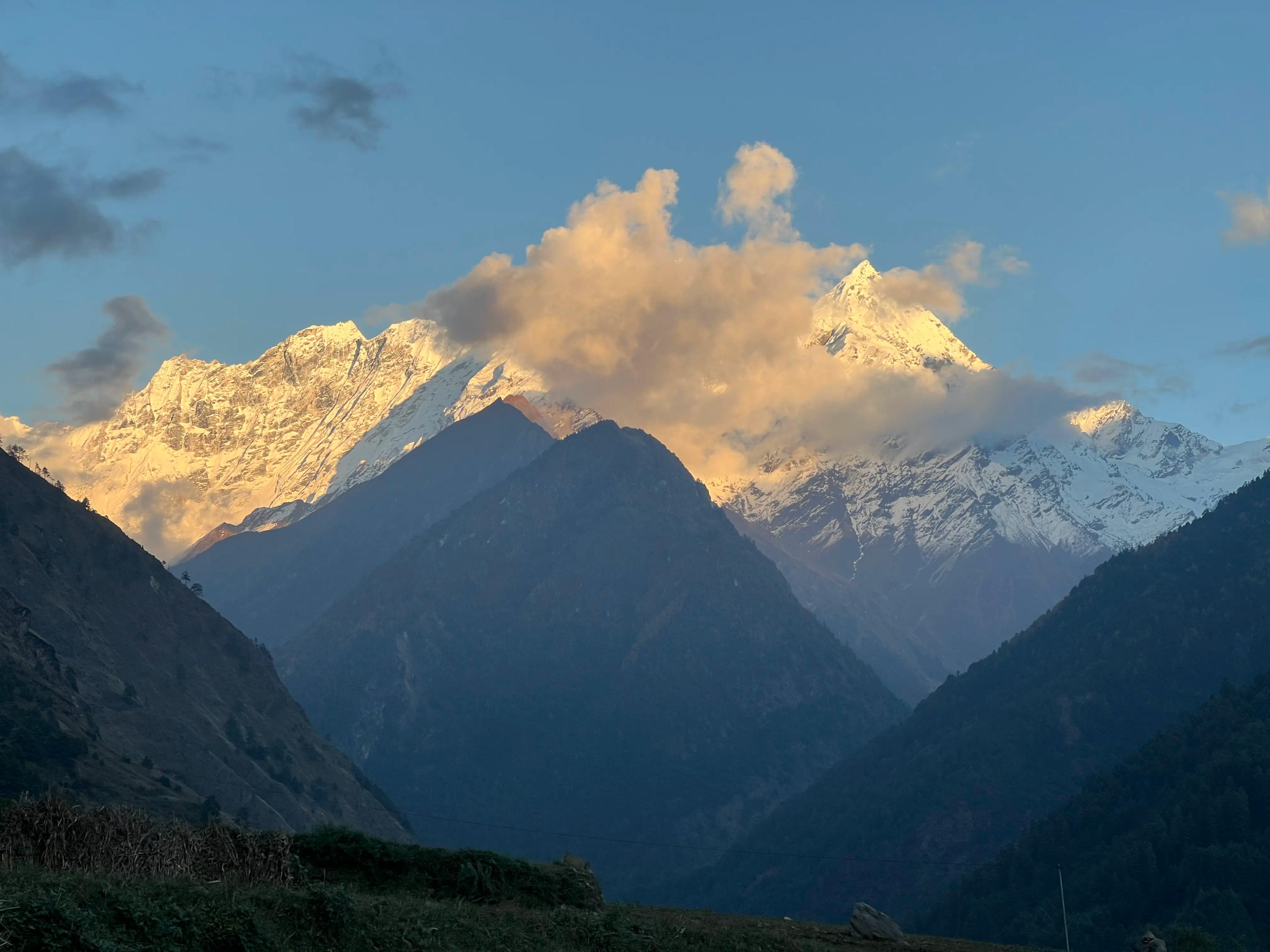
Photo: Manaslu Trek
The Tsum Valley and Manaslu Circuit Trek is one of Nepal’s most extraordinary off-the-beaten Himalayan adventures, combining untouched culture, sacred Buddhist heritage, and dramatic mountain landscapes. This 17-day journey takes you deep into the hidden Tsum Valley—known as the “Valley of Peace”—and around Mt. Manaslu, the world’s eighth-highest peak at 8,163m. The trek culminates at the breathtaking Larkya La Pass (5,106m), one of Nepal’s most stunning high-altitude crossings.
Remote, authentic, and rich in Tibetan Buddhist influence, this trek is ideal for trekkers seeking wilderness, spirituality, and cultural depth beyond the crowded Everest and Annapurna routes.
Tsum Valley is considered a Beyul—a hidden, blessed valley protected by Guru Rinpoche. It preserves ancient Tibetan Buddhist traditions, spiritual monasteries, and meditation caves dating back centuries.
Highlights include:
Tsum Valley remains one of Nepal’s least commercialized trekking regions—perfect for those seeking peace, spirituality, and authenticity.
Known as Katung I in Tibetan, Manaslu is often called the “Mountain of Spirit.”
The circuit trail offers:
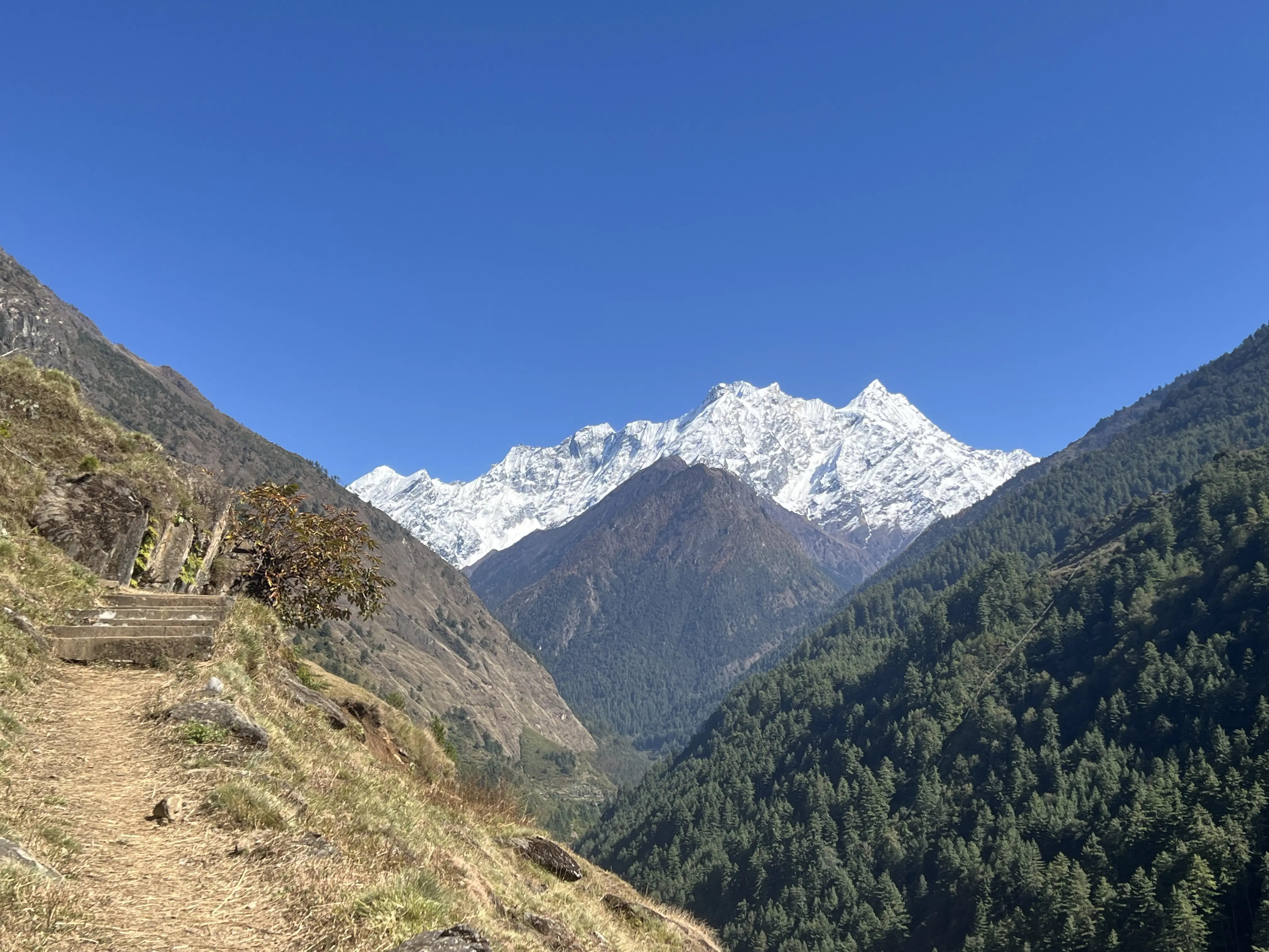
Photo: Manaslu Trek
We begin with a drive from Kathmandu to Machha Khola, covering approximately 160 kilometers.
Overnight stay at Machha Khola.
After breakfast, the day’s trek begins along the scenic trail that follows the Budhi Gandaki River. The path winds through narrow gorges, crossing suspension bridges over rushing streams and rivers, with waterfalls cascading down the surrounding cliffs. We stop at a local teahouse for lunch before continuing onward. Along the way, we pass through small villages where you can observe daily life and traditional Himalayan culture, one of the day’s true highlights.
Your journey into the Manaslu Conservation Area officially begins at Jagat, a charming village nestled at 1,370 meters beside the Budhi Gandaki River. The trek from Jagat is a visual treat, revealing dramatic river valleys, impressive suspension bridges, gushing waterfalls, and quaint, terraced hillside settlements. After approximately 2.5 22hours, you'll arrive in the scenic village of Philim. A further two hours of walking will lead you to a lunch stop. Post-lunch, you'll veer off the main Manaslu Circuit Trek path, passing through a gate adorned with seven Tibetan "meat seal" rules. This gate signifies your entrance into a Biyul of Tibetan Buddhism. The day concludes with a final 2-hour hike to Lokpa, where you'll spend the night.
This 9 km trek from Lokpa to Ripchet (2,470m) descends into a picturesque valley, revealing the untouched beauty of the Tsum region. The village trail weaves through traditional stone houses and terraced fields, offering intimate glimpses into the unique Tsumba culture. Lush forests gradually give way to more open landscapes, with the majestic Sringi Himal and other peaks framing the horizon. Ripchet itself is a tranquil oasis, known as a "precious one" and believed to be a hidden valley of Guru Rinpoche, providing a profound sense of spiritual peace amidst stunning mountain scenery.
The trek from Ripchet to Chhokang is a solid 12-kilometer journey that truly pulls you deeper into the heart of the Tsum Valley. You'll find yourself walking among ancient stone houses and their meticulously carved terraced fields, feeling like you've stepped back in time. It's not just a walk; it's a living snapshot of the Tsumba people's daily life.
As you steadily climb, the view opens up. The gentle landscape gives way to increasingly grand views, with the mighty Ganesh Himal range appearing more impressive with every step. Keep an eye out for the countless mani walls and chortens – they're everywhere, silent testaments to the profound Buddhist faith that weaves through every aspect of life here.
Finally, you arrive in Chhokang. It's a bustling little hub, full of vibrant life, where you can truly connect with the locals and soak in those panoramic, jaw-dropping views of the Himalayas all around you. It's a day that's as much about cultural discovery as it is about the incredible mountain scenery.
Today's 14-kilometer trek from Chhokang to Mu Gumba (around 3,700m) is a spiritual and scenic highlight of the Tsum Valley. As you leave Chhokang, the trail continues its steady climb, leading you ever deeper into this secluded Himalayan realm. The landscapes gradually become more austere yet incredibly dramatic, with the towering peaks of the Ganesh Himal range feeling closer than ever.
You'll pass through scattered settlements, often just a handful of traditional stone dwellings, and witness the resilient lifestyle of the Tsumba people. The path is richly adorned with mani walls and Chortens, each stone a silent prayer, emphasizing the profound Buddhist spirituality that permeates this valley.
Reaching Mu Gumba, the highest monastery in the Tsum Valley, is a truly special experience. It's not just a physical destination; it's a sacred space holding ancient scriptures and profound cultural significance. From here, the panoramic views are simply breathtaking – a vast expanse of the Tibetan Plateau stretches out before you, framed by the majestic surrounding peaks. It's a place where the grandeur of the mountains meets the deep serenity of faith, leaving a lasting impression.
After the awe-inspiring heights of Mu Gumba, today's 12-kilometer trek down to Lamagaun (around 3,200m) offers a change of pace, descending through the very heart of the Tsum Valley. Leaving the spiritual pinnacle behind, the trail meanders through landscapes that continue to captivate with their raw beauty.
You'll traverse varied terrain, from open stretches offering lingering views of the Tibetan Plateau to pathways winding through ancient forests. The air often hums with the gentle rustle of prayer flags, and you'll continue to pass countless mani walls and chortens, constant reminders of the deep-rooted Buddhist faith that defines this region.
As you approach Lamagaun, you'll notice the return of more signs of daily life – traditional farming practices and the simple, sturdy stone homes of the locals. It's a journey that seamlessly blends the grandeur of the high Himalayas with the intimate, cultural tapestry of the Tsumba people, bringing you closer to the valley's serene essence.
Today's 15-kilometer trek from Lamagaun to Chumling (2,386m) sees you continuing your descent through the picturesque Tsum Valley, bringing you closer to its vibrant lower regions. The trail gracefully follows the contours of the valley, offering a constantly changing perspective of the landscape you've just explored from above.
You'll pass through more established villages and hamlets, where the sight of terraced fields and the sounds of daily life become more pronounced. The path winds alongside the Budhi Gandaki River or its tributaries, leading you through sections of dense pine and rhododendron forests, which offer refreshing shade and a different kind of beauty compared to the higher, more open terrain. Throughout this journey, the presence of mani walls and chortens remains constant, reinforcing the deep spiritual essence of the region.
Reaching Chumling feels like arriving at a significant hub. It's a charming village, known for its traditional stone houses and its own important Gompa. From here, you'll often catch excellent views of the majestic Shringi Himal, a fitting welcome as you settle in for the night.
Today marks your farewell to the mystical Tsum Valley as you begin your return to the main Manaslu Circuit. Leaving behind the spiritual stillness of Chumling, you descend steadily toward the confluence with the Budhi Gandaki River, where you rejoin the classic Manaslu trail.
The path winds mostly downhill, passing through lush pine and rhododendron forests, with the river rushing alongside. Along the way, you’ll cross suspension bridges that swing gently over deep gorges, adding a sense of thrill to the serene scenery.
As you walk, you’ll notice the landscape and atmosphere begin to shift. The remote and deeply traditional Tsumba villages give way to more mixed Himalayan communities, easing you back into the outer world. After approximately 3 hours from the junction, you reach Deng, where you’ll spend the night in a cozy teahouse.
Deng is more of a peaceful overnight stop than a bustling village, with a few local homes scattered above a small stream. The views of Mt. Lachung and Chachung alongside the Budhi Gandaki River create a stunning backdrop.
After breakfast, we begin our day by following the Budhi Gandaki once again, crossing a suspension bridge before reaching the small hamlet of Bihi. After a short rest, we continue our scenic walk through dense pine forests, enjoying spectacular views of waterfalls and deep valleys. We cross another suspension bridge and arrive at Gyap, where we stop for lunch.
From here, the trail climbs steadily toward Namrung. Along the way, we pass an apple farm—don’t miss the chance to try some fresh apple pie! We end the day at Namrung, a beautiful village on the riverbank, where we spend the night.
As we gain elevation, the landscape and culture begin to change noticeably. The architecture shifts to Tibetan-style stone houses with timber roofs, and we begin to encounter the Tibetan-influenced people of the upper Nubri Valley. Their traditions, dress, and way of life offer a fascinating contrast to the lower regions of Nepal.
After enjoying a breathtaking sunrise over Mt. Pangboche, we begin our day with breakfast and set off on the trail. Following the Budhi Gandaki River, we continue through open valleys, passing fields of barley and potatoes, with distant monasteries and small villages visible across the riverbanks. As the valley widens, more mountain views emerge, and the settlements grow larger in size and character.
We pass through the traditional villages of Lhi and Shya before reaching Lho, where we stop for lunch. Lho is a large and lively village known for its impressive monastery and terraced fields. After lunch, we rejoin the trail, walking through a beautiful forested path alongside a stream, and begin a steady climb to the scenic village of Shyala. This charming place is dotted with monasteries and traditional homes.
From here, we gradually ascend to Samagaun, an ancient Tibetan-influenced village where we spend the night surrounded by Himalayan serenity and cultural richness.
Today is a well-deserved rest and acclimatization day in the beautiful village of Samagaun (3,530m). Surrounded by towering peaks and deep-rooted Tibetan culture, Samagaun is the heart of the Nubri Valley and an ideal place to adjust to the altitude before crossing Larke Pass.
You have a few great options for short hikes and exploration:
Explore Pungyen Monastery (4,050m): Located on a ridge with spectacular views of Manaslu, this remote gompa offers insight into local spiritual life and dramatic scenery.
After an early breakfast, we begin our trek toward Samdo, a relatively easier day compared to previous ones. Along the way, we pass scenic landmarks like Birendra Lake and an old monastery—ideal stops if you missed them the day before.
The trail leads through a breathtaking valley nestled between Mt. Naike Peak and Mt. Pangboche, with sweeping alpine landscapes, yak pastures, small streams, and sparse pine forests. After about 5 hours of steady walking, we reach Samdo, the last permanent village before the Tibetan border.
We arrive in time for lunch and have the afternoon to explore. A short hike up a nearby hill is perfect for further acclimatization, offering panoramic views of the surrounding mountains. Set beneath the imposing Mt. Pangboche, Samdo provides stunning views of the lower valley, Himal Chuli, and Naike Peak. The village is rich in Tibetan culture, and the traditional highland lifestyle here is truly captivating.
As usual, we begin our day after breakfast and gradually ascend toward Dharamsala, the last overnight stop before crossing Larke Pass. Leaving behind the peaceful Samdo village and majestic Mt. Pangboche, we cross a small stream near the Nepal–Tibet border and pass a long mani wall carved with sacred prayers.
The trail continues through a broad, open valley known as Larke Bazaar, once a seasonal trading post. With Naike Peak to the left, wide yak pastures to the right, and Larke Peak straight ahead, the scenery becomes increasingly dramatic. As we climb higher, we’re rewarded with views of massive glaciers and Manaslu North, and eventually, the striking ice-covered slopes of Mt. Manaslu itself. We arrive at Dharamsala, not a village but a cluster of basic lodges offering shelter before the high pass. Though facilities are simple, the mountain views are unforgettable. We spend the night here, preparing for the big crossing tomorrow.
We begin the most challenging and rewarding day of the trek early—waking around 3:00 AM to pack and having breakfast by 4:00 AM. The trail gradually climbs along the glacial moraine, with breathtaking views of Larke Peak and the surrounding snowcapped giants glowing in the early light.
After about 4–6 hours of steady ascent, we reach Larke Pass (5,106m) just in time to witness the stunning sunrise over the Himalayas. The views from the pass are absolutely unforgettable—on one side lies Mt. Manaslu and Manaslu North, and on the descent, you'll see a new panorama featuring Mt. Himlung, Chombi, and Kangguru.
We descend carefully down the rocky trail toward Phedi, stopping for a well-deserved lunch. The glacial lakes before and at Bhimthang add serenity to the rugged terrain. After another 1.5 hours of downhill trekking, we arrive in the beautiful valley of Bhimthang, where we spend the night surrounded by alpine splendor.
This is truly one of the most breathtaking days of the trek. The wide Bhimthang Valley, with its serene glacial lake and towering views of Mt. Manaslu, creates a magical mountain setting. As the sun rises, the peaks of Himlung, Chombi, and Kangguru light up in the north, while to the south, Manaslu glows above a forested valley with winding streams—a view that feels almost heavenly.
We descend gradually through a fairytale-like forest of tall pines and blooming rhododendrons in vibrant shades of white, red, pink, and purple. Along the way, we pass charming villages like Surke, Gowa, and Tilche, each offering glimpses of local mountain life.
From Tilche, we continue down to Dharapani, where we spend the night and reflect on the incredible beauty of the journey.
After breakfast, we begin the journey back with a scenic jeep drive from Dharapani to Besisahar, descending through lush hills and traditional villages along the Marsyangdi River. From Besisahar, you can either continue by private vehicle or tourist bus to Pokhara (approx. 5–6 hours) or return directly to Kathmandu (approx. 7–9 hours), depending on your travel plan.
Location and Geography of Manaslu Circuit Trek with Tsum Valley
The Tsum Valley with Manaslu Circuit Trek is located in the heart of Nepal, Gorkha district, and follows the Budhi Gandaki River as it climbs through deep valleys into the remote Nubri region, beyond the majestic Manaslu Range. From there, the trail ascends to the high-altitude Larke Pass at 5,106 meters, crossing stunning glacial landscapes before descending into the Marsyangdi Valley. This trek offers an extraordinary mix of untouched and rugged terrain, rich in biodiversity and ever-changing vegetation. Traversing through both the Manaslu Conservation Area and the Annapurna Conservation Area, trekkers experience a remarkable geographical journey—from lowland fields and river valleys to waterfalls, glacial lakes, alpine meadows, high mountain passes, and Tibetan-style highland settlements. It’s a diverse and awe-inspiring trek through Nepal’s wild and varied landscapes.
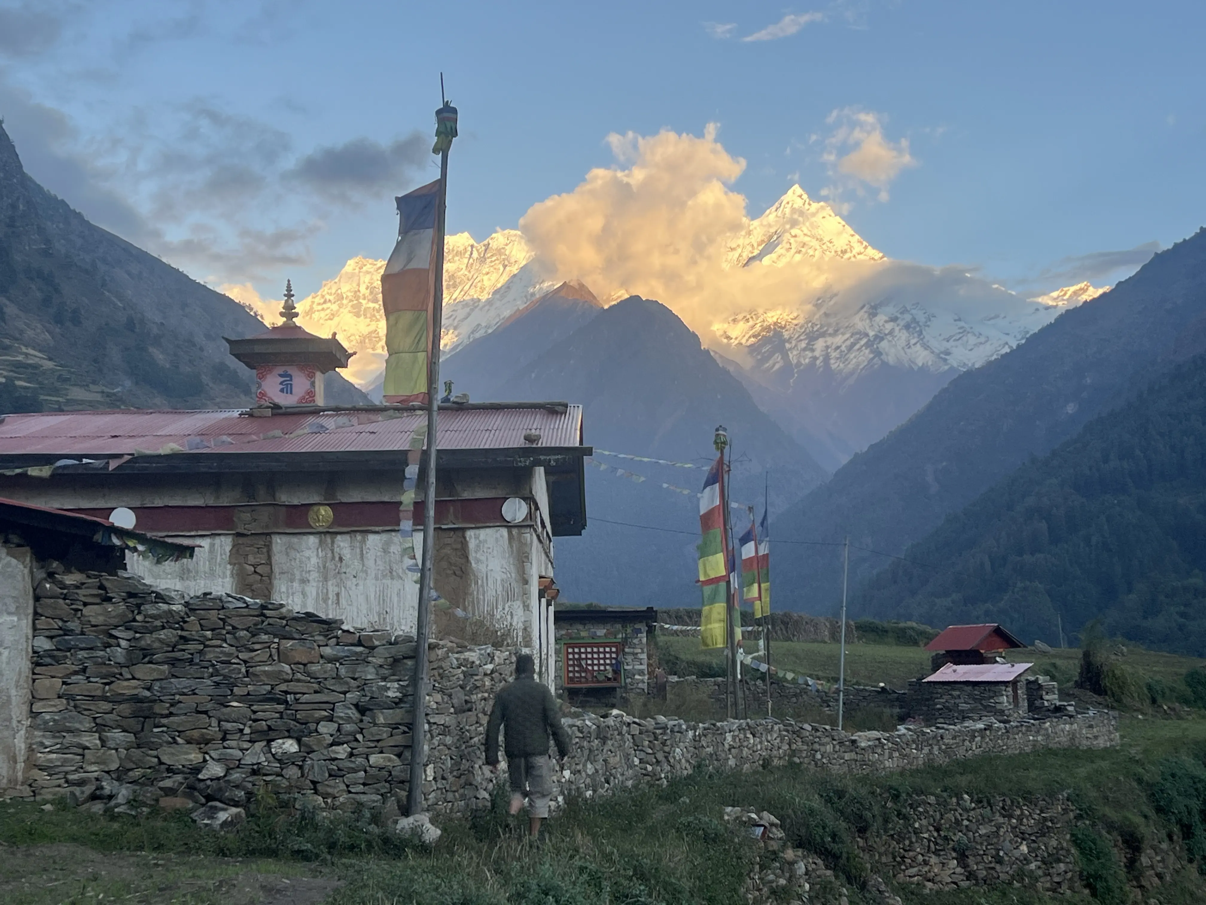
Photo: Manaslu Trek
The trek covers diverse terrain—from river valleys at 600m to glaciers above 5,000m.
Geological features include:
Stable weather, clear skies, best mountain views.
Rhododendron blooms, mild temperatures.
High rainfall but less in upper regions like Samagaun.
Cold, heavy snow near Larkya Pass.
This trek is moderate to challenging, due to:
Starts at 890m, climbs steadily to Larkya La (5,106m), then descends to 1,910m.
(Insert your altitude graph here.)
You need five mandatory permits:
Rural Municipality Entry Fee
(TIMS may be required based on the latest rule)
Go The Himalaya Treks donates 5% of all profits to Ohhee Khusi Nepal Foundation.
Follow
https://www.instagram.com/go_thehimalaya/?hl=en
Encourage responsible trekking:
The Tsum Valley and Manaslu Circuit Trek is one of Nepal’s deepest cultural, spiritual, and natural trekking experiences. With ancient monasteries, sacred landscapes, authentic Tibetan culture, and the majestic Larkya La Pass, this journey offers an unforgettable Himalayan adventure far from the crowds—with true wilderness, heritage, and heart.


